The Best Hikes in Canada for All Skill Levels
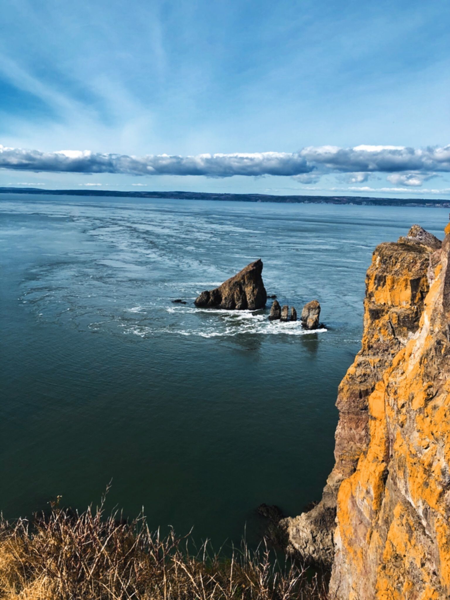
Photo taken on the Cape Split Trail by Haley Klatt via AllTrails.
Nova Scotia
Gypsum Mine Lake (Easy)
This 2.6-kilometre trail near Bellemarche is not only stunning but also provides opportunities for swimming in the summer. The hike itself is short and easy, but there is a moment at the end where people looking for the best views can climb up the rocks with the help of ropes. Sturdy children should have no problem doing this, too.
Skyline Trail Loop (Moderate)
The famous Cabot Trail in Cape Breton is home to most of the phenomenal hikes in Nova Scotia, one of the best being the Skyline Trail. This 9.5-kilometre loop starts in Cheticamp and features wild flowers and beautiful vistas with 237 metres of elevation gain.
Cape Split (Hard)
This well-loved 13-kilometre loop is a short drive from Halifax in the town of Glenmont. The dramatic bluffs and untamed sea make for a picturesque trek along the Bay of Fundy. Make sure to have proper clothing for the season, hiking footwear, lots of water, and some snacks, because this one will take a good chunk of your day. Stick to the trail, and you should be in and out within five hours.
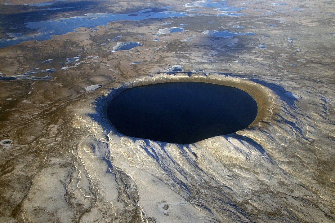
An aerial view of the Pingualuk Crater.
Quebec
East Point National Wildlife Area (Easy)
This flat, marshy landscape is great for bird watching and leisurely hiking. Located on the Îles de la Madeleine, there are two trails to chose from. La Camarine is the easiest, and the jaunt is short but satisfying.
Mont Chauve Trail (Moderate)
North of the shores of Lake Stukely and on the edge of Mount Orford National Park is Mont Chauve. The looping trail is 9.5 kilometres long with a fair amount of elevation gain, but the views at the top are definitely worth it.
Pingualuit Crater (Hard)
This is an easy hike that is difficult to get to, but believe us when we say it is worth the effort. The water-filled crater known as “the Crystal Eye of Nunavik” was formed by a meteor crash and can be found in Parc national des Pingualuit in Northern Quebec. The park offers multi-day trekking excursions and camping to experience everything the site has to offer. That is the only way to see this marvel in person, making it for dedicated hikers only.
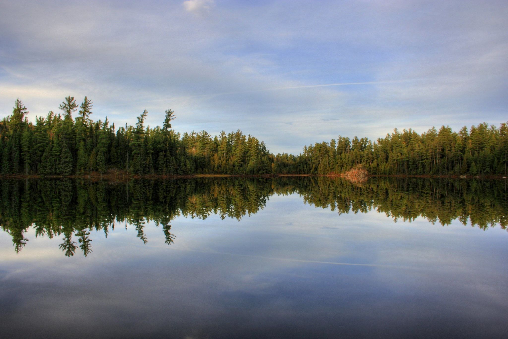
Photo by Steven Burke via AllTrails.
Ontario
White Bear Forest Old Growth Trail (Easy)
This hike is as easy or difficult as you choose to make it. The network of trails through Finlayson Point Provincial Park is great for forest bathing in the red and white pines. The Link and Beaver trails are the shortest at two kilometres in total, but they connect with the five-kilometre Red Fox Trail, which we recommend because it takes you on a loop past Pleasant Lake.
Ishpatina Ridge Tower Summit (Moderate)
At 693 metres above sea level, Ishpatina Ridge is the highest point in Ontario. The first half of this hike to the summit is fairly level, but be ready for a bit of a climb in the second half. The trail isn’t the best maintained, but that makes for a more adventurous experience. Starting at Scarecrow Lake, the in-and-out trail is about four kilometres and should take two hours round trip.
Maple Mountain (Hard)
This one is hard because it’s a double whammy of exercise. The hike itself is only 3.2 kilometres, but getting there involves a 40-kilometre paddle through Lady Evelyn-Smoothwater Provincial Park. The four-day trek (shorter, depending on how fast you take it) to the 100-foot abandoned fire tower at the summit of the mountain is a full adventure. The paddling begins at Mowat’s Landing, then winds through Lady Evelyn River and Lake before ending in Tupper Lake with a small amount of portaging. Be thoroughly prepared and do your research before you go, but it is worth the time.
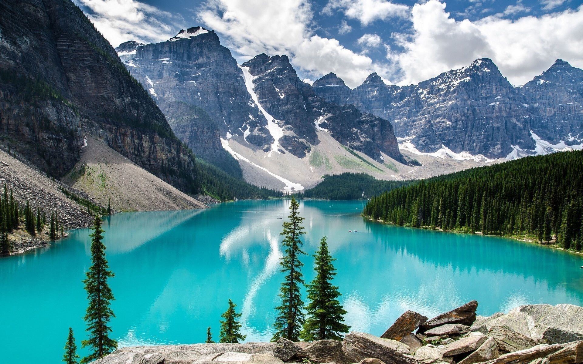
Moraine Lake photographed by Tiffany DeGuzman via AllTrails.
Alberta
Moraine Lake Rockpile Trail (Easy)
The Moraine Lake Rockpile Trail is less than a kilometre long with minimal elevation gain. Looping around the gorgeous glassy lake, it is perfect for a short morning or afternoon stroll. The hike is extremely popular, so we recommend going as early in the morning as you can manage if you want to avoid the crowds.
Plain of the Six Glaciers Trail (Moderate)
Easily accessible from the Fairmont Chateau Lake Louise and with a teahouse pit stop along the way, this 14.6-kilometre in-and-out trail can be done in sections. The rugged mountains are juxtaposed with the placid glacier water and offer lots to look at the entire way. If you are willing to do it on an overcast day, there will be fewer tourists hogging the trail—it is still beautiful even when cloudy.
Sarrail Ridge via Rawson Lake Trail (Hard)
A truly unparalleled view looks down on turquoise water from a rocky, moss-covered bluff. Something about it never gets old. Parts of the 11.3-kilometre trail can be closed due to bear activity in the summer, but there is plenty to explore nonetheless. Elevation is 1,066 metres, and there is still snow nearing the top so be prepared for the conditions. Snow won’t completely dissipate until late summer.
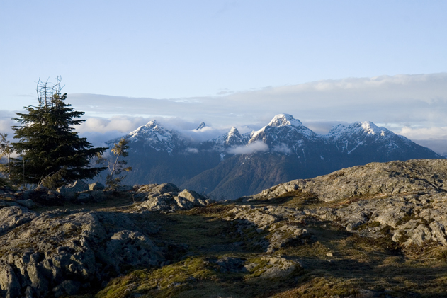
The view from Tin Hat cabin on the Sunshine Coast Trail.
British Columbia
Wild Pacific Trail: Lighthouse Loop (Easy)
This trail near Ucluelet on Vancouver Island was designed by a photographer which means every bend and break in the tree-line is a photo-op. The 2.6-kilometre loop follows the coast and offers views of the Barkley Sound, Inspiration Point, and Amphitrite Lighthouse, for which it’s named. There are also lots of contorted trees that make great climbing spots for kids (or kids at heart).
Eagleridge Bluffs via Black Mountain Trail (Moderate)
It wouldn’t be a hiking roundup without a nod to the hub of hiking in B.C., the North Shore. While the interior of the province has lots of trails to chose from that offer views of the desert brush mountains and vineyards, the evergreen forests of the Sea-to-Sky region draw hikers from all over the country. One of our favourites is Eagleridge Bluffs, which is an 8.2-kilometre hike in Cypress Provincial Park. There are great views of Lighthouse Park, Horseshoe Bay, and Point Grey at the top, but the chance to picnic by or even jump into (if you can brave the cold) Yew Lake is a huge draw.
Sunshine Coast Trail (Hard)
The Sunshine Coast Trail which begins in Powell River stretches 180 kilometres and includes a dozen huts and 20 tent sites along the way. There are dozens of entry points, so people who want to dedicate a day to camping can hike into one site and back without camping, But we think the trail is best experienced at least overnight, if not over multiple days.
________
Never miss a story. Sign up for NUVO’s weekly newsletter here.